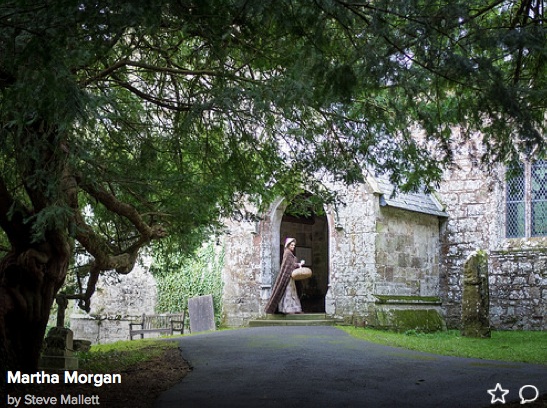
IT IS OBVIOUS TO ANYBODY WHO WALKS OR DRIVES ACROSS THE LANDSCAPE OF MARTHA MORGAN COUNTRY THAT THIS IS A REGION PACKED WITH HISTORIC FEATURES RANGING IN AGE FROM THE STONE AGE TO INDUSTRIAL REVOLUTION AND THE MODERN ERA. THE OLDER FEATURES WOULD CERTAINLY HAVE BEEN FAMILIAR TO MISTRESS MARTHA, EVEN THOUGH THEY MIGHT NOT HAVE BEEN AS "VALUED" AS THEY ARE TODAY. MANY HERITAGE FEATURES ARE OF COURSE CATALOGUED AS SCHEDULED ANCIENT MONUMENTS OR LISTED BUILDINGS TODAY, AND SOME URBAN LANDSCAPES ARE PROTECTED AS "CONSERVATION AREAS". MOST OF THE LANDSCAPE HEREABOUTS LIES WITHIN THE PEMBROKESHIRE COAST NATIONAL PARK, AND THIS DESIGNATION ADDS A FURTHER LAYER OF PROTECTION. BUT THERE IS ALSO A GREAT DESIRE AMONGST LOCAL PEOPLE TO SEE THE "BUILT HERITAGE" RESPECTED AND PROTECTED - NOT JUST REGARDING ANCIENT RUINS BUT ALSO THE STONE AND SLATE DWELLINGS AND OTHER BUILDINGS WHICH ARE IN CURRENT USE.
Pentre Ifan
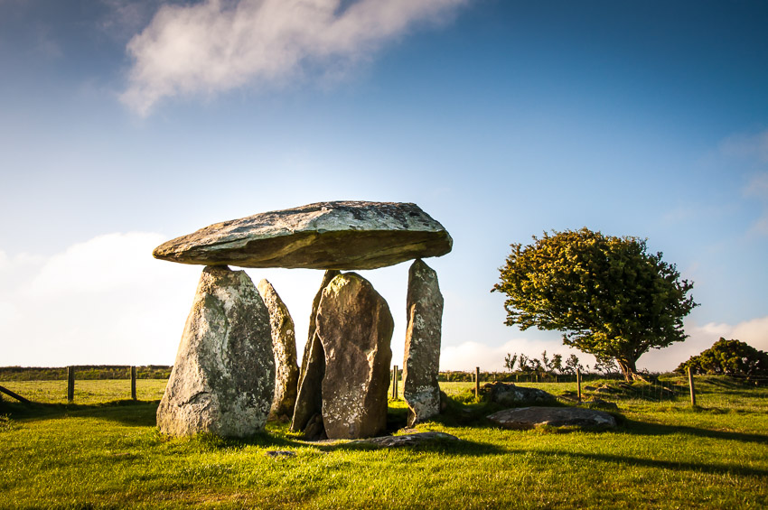
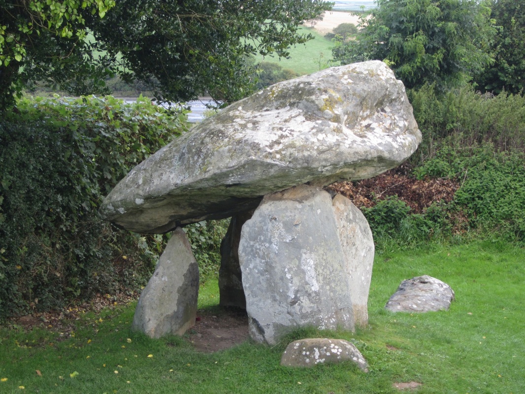
Pentre Ifan is undoubtedly the most popular megalithic site in Wales. Its location is truly spectacular. It is a splendid burial chamber (dolmen or cromlech) with a huge capstone delicately poised on three uprights. It was once known as Arthurs' Quoit. It dates back to about 3500 BC and it stands on the slopes of a ridge commanding extensive views over the Nevern Valley and towards Carningli. The elegant capstone weighs over 16 tonnes; it is 5m long and stands 2.4m off the ground. The stones of the chamber are all made local volcanic ash; on the portal stone there is a faint decorative cupmark. We can assume that the monument was built here because this was where a cluster of very handy stones were located.
Excavations have shown that the burial chamber originally lay within a shallow oval pit, and that the trapezoidal mound of earth covering it was up to 36m long. The semi-circular façade, as in the Irish court-tombs, was marked by two upright stones on either side of a massive slab that forms the south-facing portal. The forecourt was blocked with rows of tightly wedged stones; some of the original kerbstones around the barrow can still be seen. Within the cairn were a number of enigmatic features: a slumped stone, deliberately felled before the cairn was built, an irregular line of small stone-holes and a pit with signs of burning. No trace of burials was found here, but we may assume that such a large tomb would have been used for collective burial over many years. The number of artefacts discovered was very small; a recent analysis suggests that Pentre Ifan may be a structure built in two periods: the original portal dolmen tomb could have been later embellished by a cairn and a façade. Local folklore says that sometimes fairies are seen here on moonlit nights. Garn Fawr
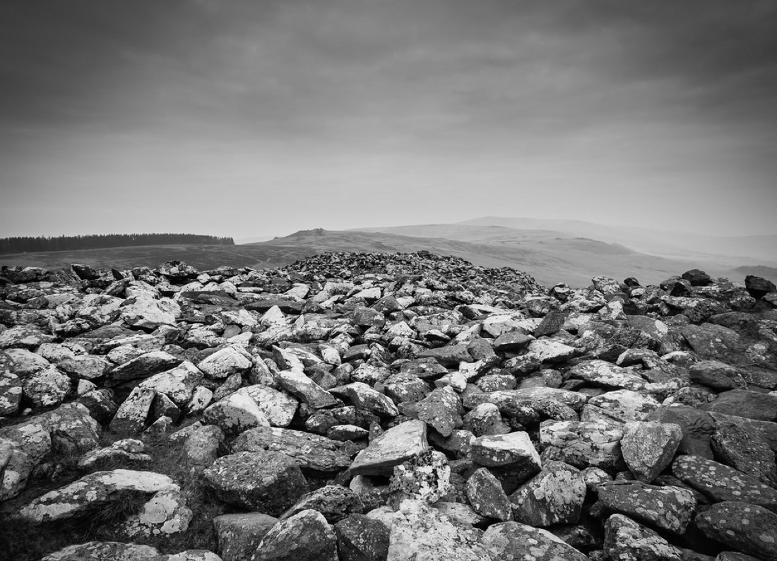
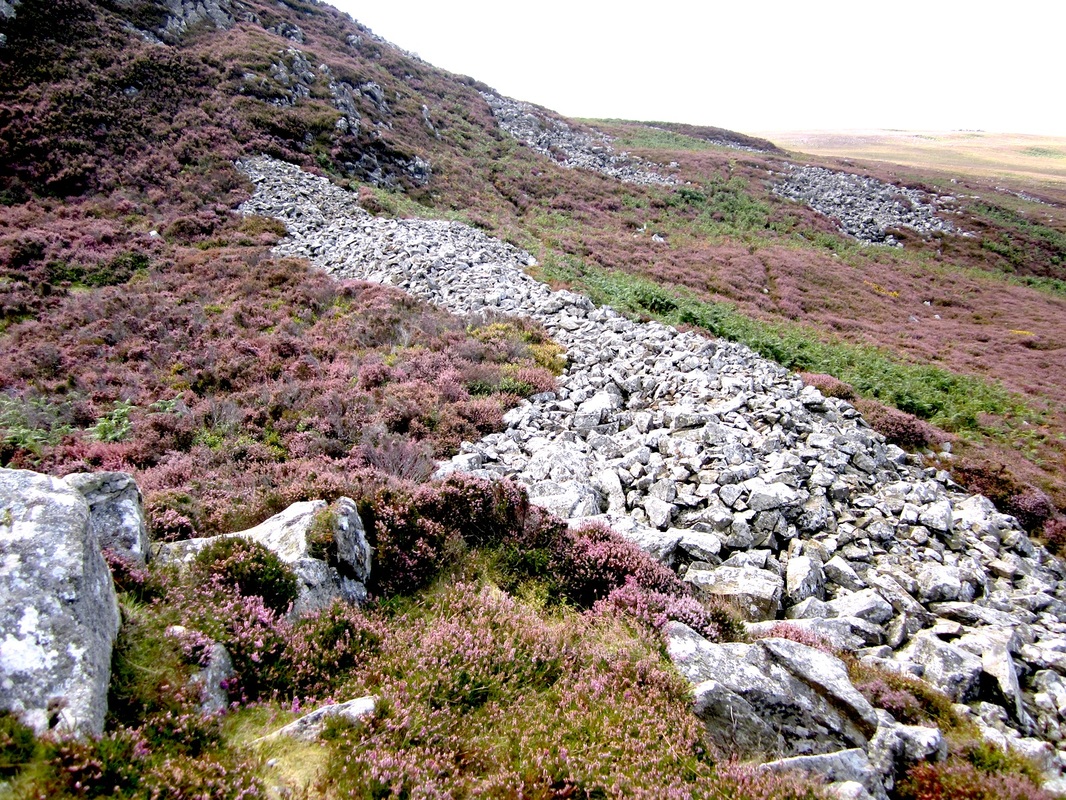
The great hillfort of Garn Fawr enjoys one of the most spectacular locations in Pembrokeshire, high up on a volcanic crag overlooking the west coast of Pen Caer. From the highest point within the defensive walls you look SW along the great rampart of cliffs which runs up to Pwllderi beach. This Scheduled Ancient Monument was sited with sound common sense, for it dominates all approaches. Today, in spite of much damage and stone-robbing over the centuries, we can still see a complex set of stony banks and ramparts formed of loose scree. These attest to a long and complex history, although the fort is conventionally dated to the Iron Age. Not far away there are two other forts -- that at Dinas Mawr is a nearby promontory fort on the cliffs, and Garn Fechan is a smaller fort on an adjacent hill summit. On the flank of the fort is a cottage which was used by the artist John Piper.
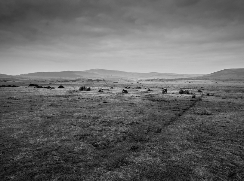
Gors Fawr Stone CircleGors Fawr stone circle, on the moorland near Mynachlogddu, is the only stone circle left in Pembrokeshire. It is greatly revered, but in truth it is not very impressive, consisting of a group of low stumpy stones collected up by the Bronze age builders from the glacial erratics that littered this landscape. But the setting is undoubtedly spectacular, with the crags of Carn Meini dominating the scene on the upland horizon.
The Golden RoadNorth Pembrokeshire is full of ancient tracks, which can be found if you know where to look. One of the oldest is the “Golden Road” which runs along the crest of the main ridge of Mynydd Preseli. It is probably a trading route established by Bronze Age people and used more or less continuously for the last 5,000 years. Many of the standing stones of the county may also mark ancient routeways. As the years passed more and more footpaths and bridleways were opened up, and many of these were maintained as “traditional” routes even after the enclosure of much of the old common land took place. The drovers had many routes of their own, used to drive herds of cattle, geese, sheep and pigs from the Pembrokeshire collecting points to the markets of South Wales, Birmingham and London particularly in the period 1750 -1850. Sections of the old drover’s roads can still be seen, especially in the uplands. There is a deeply-rutted pre-turnpike road near Tafarn-y-bwlch, and traces of an old “pilgrim’s way” can be seen in the stepping stones across the Nevern River near Newport.
The Holy Well at Llanllawer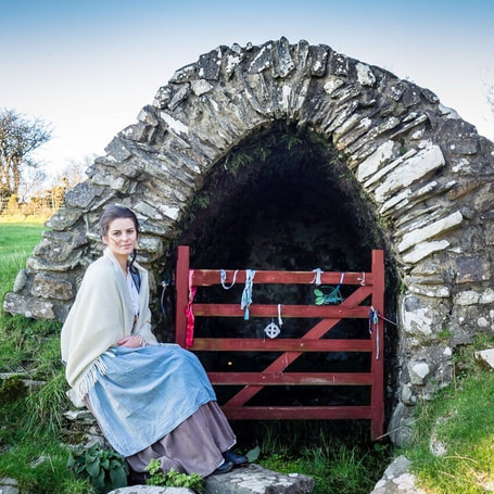
The only known holy well or spring high on the Carningli-Dinas Mountain ridge is at Llanllawer, adjacent to a semi-derelict bellcote church which was rebuilt in 1859. The spring, which still flows, is contained within a rough stone-vaulted structure open on one side. Its presence suggests that there was an Early Christian settlement here, and this ties in with the elliptical shape of the original churchyard. Probably there was a religious site here even before the arrival of the Celtic saints. According to Richard Fenton the well was efficacious for eye complaints, and it was also known as both a cursing and a wishing well. Pins and coins might be placed in it, as an encouragement to wish-fulfilment. The well is still used for sacred purposes -- there are always ribbons tied to the gate, and also posies and other momentos of loved ones.
Nevern Church
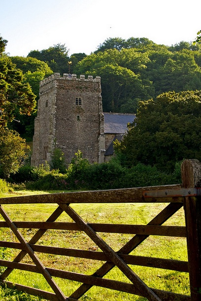
The Norman church of St Brynach is on the site of St Brynach's 6th century "clas" or monastic community, and it was once an important ecclesiastical centre. At the time when it is said that Dyfed had seven bishops, this was probably the seat of one. Except for the stumpy castellated tower, perilously undercut by the adjacent river Caman, most of the original Norman structure of the present building has been rebuilt.
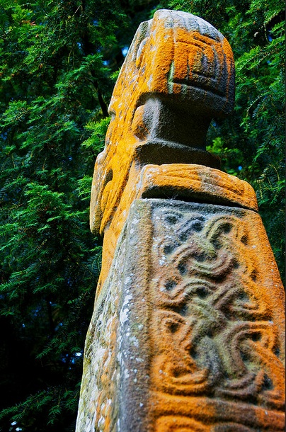
The church and churchyard are remarkable for the Celtic Cross and several inscribed stones. The famous Nevern Cross on the south side of the church dates from the 10th century or early 11th century. It consists of two sections fitted together with a mortice and tenon joint, both cut from the local dolerite stone. It has classic braided decorations and inscriptions reading "dns" on one side and "h.an.eh" on the other. Nearby is the Vitalianus Stone, dating from around 500 AD, inscribed in Latin "VITALIANI EMERTO" and in Ogham "vitaliani". In the Trewern Chapel in the south transept, two inscribed stones are set into the window sills. The Maglocunus Stone is inscribed in Latin "MAGLOCUNI FILI CLUTORI" and in Ogham "maglicunas maqi clutar.." and is of the 5th century or early 6th century. The Braided Cross is of the early 10th century. The churchyard also contains a "bleeding yew" that leaks red sap at certain times of the year, and this has given rise to several local legends. In fact, this site has more legends per square yard than any other site in Pembrokeshire -- and that attests to its vast cultural importance. The eccentric historian George Owen is buried here, and he is commemorated by a plaque in the Henllys Chapel behind the organ. In the churchyard there are several family enclosures, in one of which there is the famous and poignant epitaph to two dead infants: "They tasted of life's bitter cup, Refused to drink the potion up, But turned their little heads aside, Disgusted with the taste, and died." The Old Court House
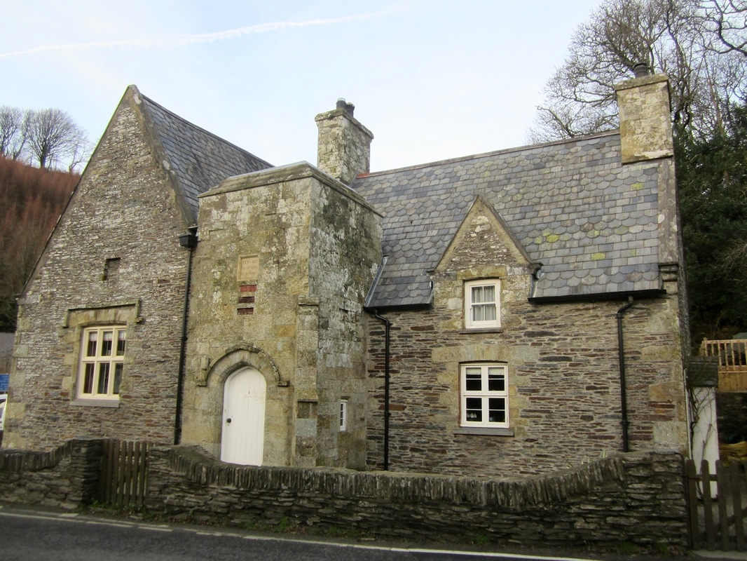
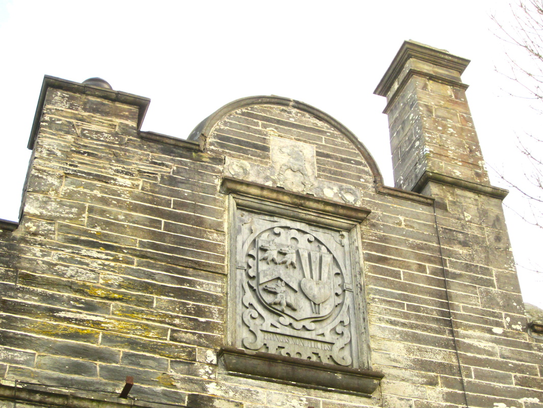
The impressive building on the bend of the main road in Felindre Farchog is variously called "The College" and "The Old Court House". It looks as if it is Tudor, but there's a date of 1852 on the wall, indicating that it was rebuilt and remodelled at that time. Originally it was a manorial courthouse for the Barony of Cemaes, but in the time of the historian George Owen it was a part of the Henllys estate, and was used as a schoolroom. It's reasonable to think that the building -- in its various incarnations -- was used for the local Petty Sessions and for meetings of the Court Leet.
Bedd yr Afanc
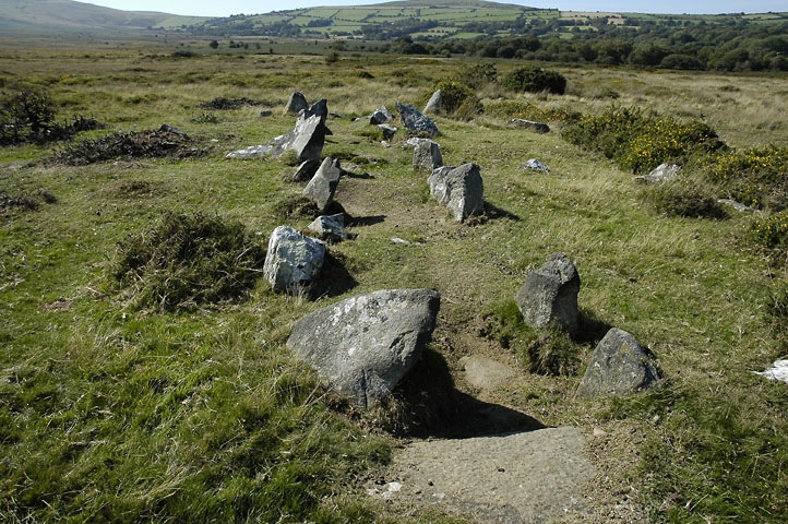
All we know about Bedd yr Afanc is that it is a ruinous gallery grave or passage grave with certain similarities with Irish or Scottish gallery graves, located on a low mound in a very boggy and open landscape on the north flank of Mynydd Preseli. It is not far from the village of Brynberian. What we see today is a remnant of a single long gallery, without any side chambers. It's the only grave of this type in Wales. It's in a very beautiful location.........
There is a row of paired stones, nearly all of them less than a metre high -- with some traces of fallen capstones. The gallery is just over 10m long. One would expect there to be more capstones present (maybe at least ten of them) -- and some have suggested on this basis that the building project was never completed. Nobody knows whether there was a large mound over the top of the stone structure -- the consensus is that this would have been unlikely. Rhosygilwen Mansion
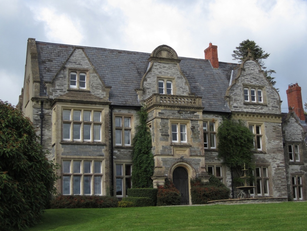
This is one of the grander mansions of Pembrokeshire. located in rolling countryside not far from Cilgerran. It was built around 1830 as a replacement for an older house, in a style referred to as "domestic Gothic." It gradually fell upon hard times, and was partially destroyed by fire in 1985. Now it has been restores and renovated to a high standard, and has become one of the premier concert and event venues in West Wales. The new Oak Hall is a superb concert hall, used for weddings, recitals, operas and lactures, and as the focal point of the annual PENfro Book Festival in September. Some of the estate farm buildings remain. The walled garden is still in good repair and provides produce for the Oak Hall's adjoining restaurant. Across the car park there is a low-energy show house called Ty Solar, and behind it is Wales's first large-scale solar park which feeds electricity into the grid.
Hammet HouseThis used to be called Castell Malgwyn Mansion. It's located close to the Llechryd Bridge over the Teifi, and it was the home of Sir Benjamin Hammet, who ran a very strange industrial enterprise called the Penygored Tinplate Works, which made tin boxes in a very early part of the Industrial Revolution, before 1800. The works were served by a canal which connected to the river a little way downstream. The mansion was also built around 1798, but the works closed in 1806 because it broke one of the main laws of industrial location: virtually all of the raw materials needed for the metalworking process had to be imported at great expense. Since then the mansion has had a chequered history, and is now used as a hotel, restaurant and wedding venue.
Rosebush Quarries
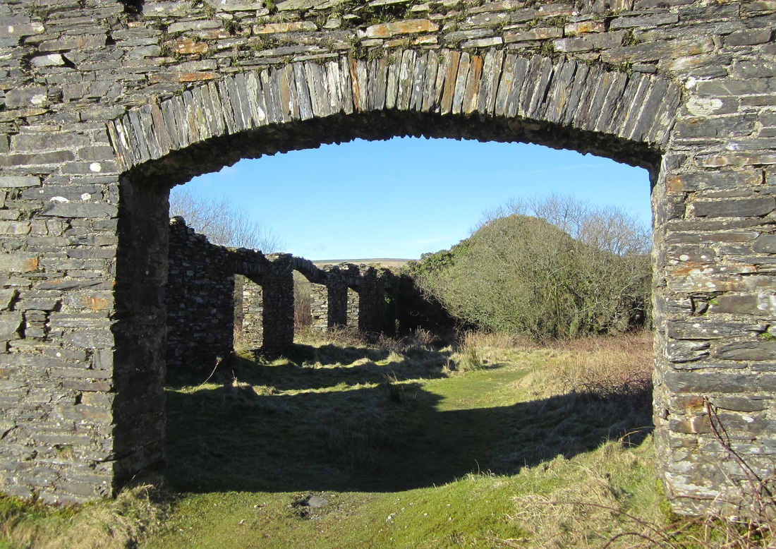
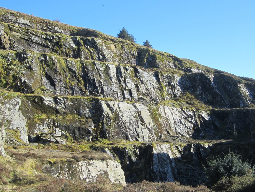
Slates from the Rosebush Quarries have been used on the roofs of many Pembrokeshire houses for hundreds of years, and were even chosen for the roofs of the Houses of Parliament. The newer slate quarries close to the village were operating in the middle 1800's, and as demand for roofing slates grew the Narberth Road and Maenclochog Railway was built in 1876 in order to provide easy export facilities. The line somehow attracted sufficient passenger traffic to encourage six years of development at Rosebush Station. The quarry owners financed the excavation of artificial lakes which were stocked with fish. A coach service to Fishguard was inaugurated, stables were built adjacent to the station, and the Prescelly Hotel was built to accommodate tourists. Extensions were carried out in the quarry, and twenty-six cottages were built for the workers. Tourists were expected to flock in by rail, and considerable sums were spent on advertising the attractions of the hills. By 1880 the population of Rosebush had risen to 179 persons. After a series of financial escapades the line was linked to Fishguard in 1899, but it was badly constructed and enjoyed only short prosperity. In 1906 the direct line from Haverfordwest to Fishguard was opened, and Rosebush became a backwater overnight. The slate quarries closed, and later the whole railway track was lifted during the First World War. By 1923 the G.W.R. (who now owned the line) had re-laid the track again, and further attempts were made to attract tourist traffic. Unfortunately in spite of energetic advertising, no more than 50-100 passengers a week could be induced to use the line, and passenger services ceased again in 1937. In 1949 the last goods train ran on the North Pembrokeshire branch, and in 1952 all of the track was lifted. The steps of the main quarry pit dominate the landscape, and visitors can still see the quarry buildings, the old station, the quarrymens’ row, the ornamental gardens, the managers office, and the famous corrugated iron hotel (now named Tafarn Sinc).
Newport Castle
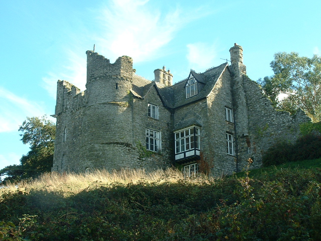
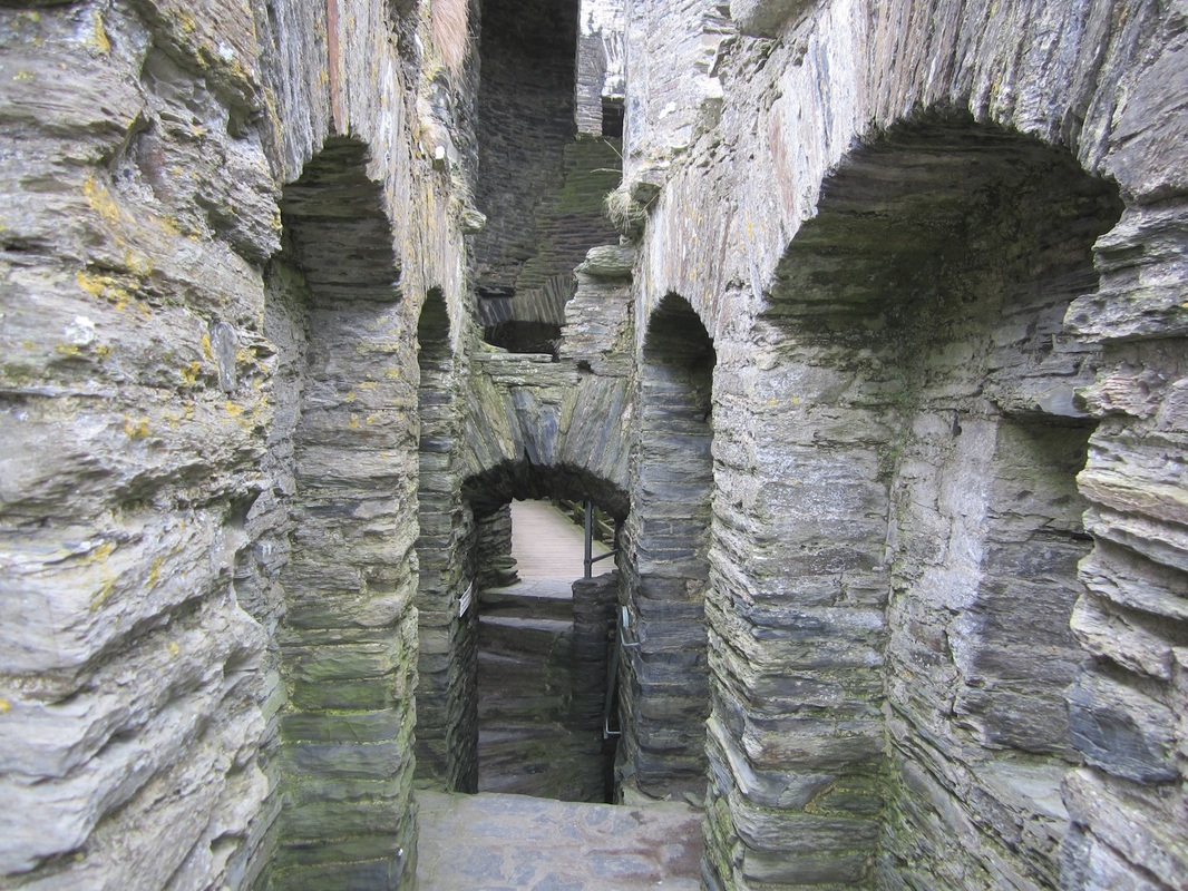
Newport Castle was probably founded by the first Lord Marcher of Kemes, Martin de Turribus in 1191 and rebuilt by his son William at the end of the 12th Century. None of this original castle survives, and the oldest remaining parts of the building are thought to date from the late 13th century. The Castle was captured by Llywelyn the Great in 1215 and Llywelyn the Last in 1257 but on both occasions was recaptured. Ownership of the castle later ransferred to Lord Audley in 1324. The fabric of the building was extensively damaged during the Welsh Revolt at the start of the 15th century. The castle was temporarily transferred to the crown when James Audley was executed for high treason and all his lands seized in 1497, but these were returned to his son in 1534. William Owen of Henllys bought the castle nine years later, and later on George Owen (the exuberant chronicler of Pembrokeshire history and geography) argued for many years that he was the rightful Lord of the Barony of Cemais, while the castle became more and more ruinous. In Martha Morgan's day it was uninhabitable. A three-storey private residence was built in 1859 on the site of the castle's gate-house, as part of renovations carried out by the owner at the time, Sir Thomas Lloyd. At this time one of the flanking towers of the gatehouse was demolished. Three other towers at the corners of the building remain, along with a curtain wall, and there is a vaulted crypt adjoining the south-eastern tower. The castle was listed with Grade I status in 1952. Today, the building remains in the ownership of the Hawkesworth family, and is not open to the public.
St Dogmaels Abbey
The site takes its name from Dogmael, a 6th-century Christian saint, reputedly the cousin of St David . The Abbey was founded by Robert fitz Martin and his wife, Maud Peverel, in 1120, and built on, or very near to, the site of the ancient pre-Norman-conquest church of Llandudoch. Partly because of its favourable location on the banks of the River Teifi not far from the lowest bridging point, it became a place of great spiritual and cultural significance. It was famed for its impressive library. One of St Dogmaels’ literary gems, the 13th-century Eusebius’s Historia Ecclesiastica, survives to this day in St John’s College, Cambridge. The parish church, which stands alongside the abbey today, is of much later Victorian origins. Links with the medieval past remain amongst the ruins of the old abbey church where original 15th-century floor tiles can still be seen in large areas along the length of the nave.
Construction of the abbey continued from the 12th through to the 16th century when, following the dissolution, it was converted into a private mansion. High profile individuals such as Gerald of Wales (Giraldus Cambrensis) and the Archbishop of Canterbury enjoyed the overnight hospitality of the abbey -- but at one time, because of its remoteness from the main centres of the ecclesiastical world, the monks who inhabited the Abbey rather lost sight of higher things, and the place became famous as a centre of corruption and debauchery........... The Druid's Cave
This cave is located in Tycanol Wood, beneath one of the highest crags near the top edge of the woodland. Local children refer to the cave as “the Druid’s Cave”, and this continues a centuries-old tradition that around the end of the Iron Age and before the arrival of the Celtic Saints the druids used glades in the wood for their religious ceremonies. Indeed, the story of the treasure of Trewern is tied in closely to this tradition. There is no actual evidence of the druids being here at all, but this is certainly a very atmospheric place, and in the woodland there is a small Iron Age fortification. So it is perfectly possible that the community which lived in this defended settlement included druids or other men and women practised in the arts and mysteries of the old religion. During the First World War the cave was lived in by a local man called Simon Hughes, who was a conscientious objector. The Army searched for him frequently, but never found him, and he was never punished for deserting.
Carningli Mountain Railway
At the top of the green track that leads up the mountain from the Dolrannog Road parking area, there are two masonry pillars with a narrow gap between them. At the top of each pillar there are two hefty threaded bolts. There is a straight green track running down from these pillars to the road, and here and there the track is either embanked or in a cutting. Several old iron railway sleepers are visible on the trackway in the turf. So this must have been the site of a narrow-gauge railway line. There is another shallow cutting which leads to an area where stone has clearly been taken from the mountainside. In this area there are several piles of stones, each one approximately the size of a human skull. To the right of the pillars there is a ruinous and rather rough hut, which appears to have been used as a shelter of some sort. These relics of Carningli’s industrial revolution were created between the two World Wars, when there was a heavy demand for crushed roadstone. The stone pillars supported a cable drum; loaded wagons were let down with the aid of a braking system to a crushing plant adjacent to the Cilgwyn Road, and then hauled back up again with the aid of a diesel engine which turned the drum. The quarry and crushing plant operated for just a few years, around 1930.
Newport Prehistory
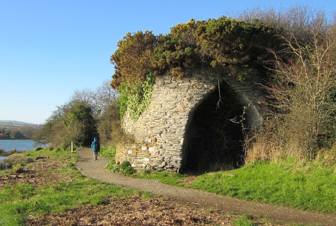
One of the most important “ancient monuments” within the confines of the town is the cromlech (Neolithic burial chamber) of Carreg Coetan Arthur, a short distance south of Pen-y-bont and standing incongruously in a small housing estate. On the outskirts of the town there are other ancient features which inform us about aspects of local life in days gone by. These include the cromlechs of Cerrig y Gof, Llechydrybedd and Trellyffaint, the Iron Age hillforts at Carningli and Carnffoi, Bronze Age settlement features on Mynydd Caregog, the old "sea quarries" on the cliffs west of Cat Rock, and the old Pont Ceunant viaduct. Closer to town are the Shiphill lime-kiln (in Nevern parish), the magnificent old cattle pound off Ffordd Bedd Morris, and the Iron Bridge and medieval stepping stones across the estuary between Newport and Berry Hill. Some of these features are visited by Martha and mentioned in the pages of the Saga.
Newport Cattle Pound
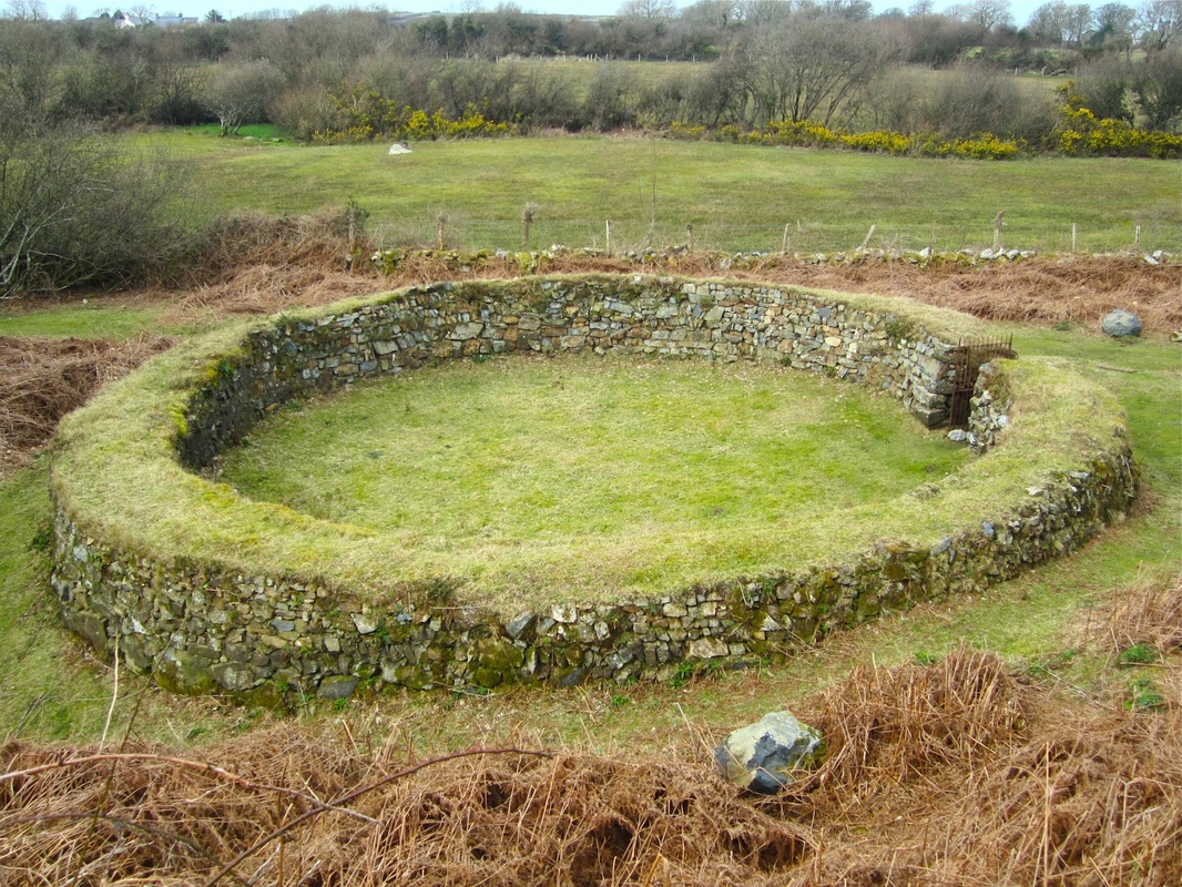
The beautiful circular cattle pound which is located in a hollow just to the west of Ffordd Bedd Morris probably dates from the Middle Ages. The records from the 1600’s show that the Mayor appointed the Bailiff and Pound Keeper, who was entitled to gather up stray animals and to enclose them so that they could do no damage to other peoples’ crops or “steal” grazing from land belonging to other farmers. The owners of stray animals were then entitled to recover them on payment of two pennies per head to the pound keeper.
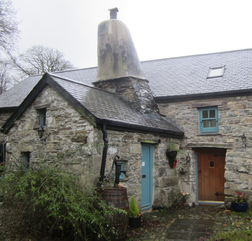
The pound was a substantial one, with massive head-high stone walls. It had an iron gate which could be locked. It was in a poor state of repair in 1834, but continued to be used until 1930. Dillwyn Miles tried to get it repaired in 1951, but his plans were opposed by the burgesses on the grounds that it was a “symbol of feudalism”! He might have replied that the burgesses themselves were feudal anachronisms. So for many years prior to 1990 the pound lay unused and overgrown. But then, as a result of a community project, it was cleared and restored. Y Garn Flemish ChimneyChimney experts recognise three types of medieval domestic chimneys in Pembrokeshire. Most of them were square; some of them were cylindrical like those in St David’s Bishop’s Palace and Monkton Old Hall; and others were conical or tapering. Farmhouses with massive conical chimneys were at one time common in Pembrokeshire, but now few remain. Most of these are in the St. David's area, but one of the best is on the old farmhouse of Y Garn, not far from Llanychaer. They were built in the fifteenth and sixteenth centuries, and demonstrate the adaption of castle building techniques to the requirements of domestic architecture. Generally these dwellings were occupied by husbandmen or yeomen, and were more solid and elaborate than the cottages of labourers and poor craftsmen. While round chimneys are generally referred to as "Flemish" chimneys in Pembrokeshire, there is no evidence that they were either built by Flemings or that their distribution coincides with the area of medieval Flemish settlement.
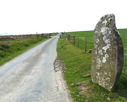
Bedd Morris Standing StoneThis is the most famous of all the Bronze Age standing stones in the Newport and Carningli district, and as indicated later, it is associated with at least two different legends. It has been used for the inscription of an OS benchmark, and it also carries an inscription placed there by Sir Thomas Davies Lloyd (TDLL) around 1850, using it as one of the marker stones to define the boundaries of the parish of Newport and to reinforce his status as the Lord Marcher of Cemais. The stone is impressive enough, but since it does not appear to be associated with any other Bronze age features there is some doubt that it is in its original position. Some years ago somebody in a heavy vehicle reversed into the stone and snapped it off at the base; but at great expense it has now been repaired and put back into its socket at the roadside.
There are two local legends which help to explain the name, which means “the grave of Morris.” According to one, Morris was a highwayman who terrorised the old road across the mountain and who relieved many travellers of their possessions. He lived in a cave up among the crags on the mountain top (maybe at Parc Mawr), and his only friend was a little white dog. But at last the locals organized a posse and attacked his cave. He was caught, together with the dog. The dog’s throat was cut but he was hanged by the roadside on a gallows erected for this purpose. As his corpse hung there on its taut rope, swinging grotesquely in the constant wind that buffets the mountain, the authorities determined to erect a stone which would act as a reminder to following generations that highway robbery does not pay. More romantic, but equally sad, is the legend of a young man called Morris who lived in Newport hundreds of years ago. He was desperately in love with the fair maid of Pontfaen, and she with him. But her father the squire considered Morris to be beneath her station and would not give consent for the marriage. Instead he arranged a marriage with another young man, in spite of the tearful entreaties of his daughter. So the young people decided, secretly, to resolve the issue themselves. Morris challenged his rival to a duel, and they met up on the mountain, at the highest point on the road, to fight to the death. Morris was killed in the duel, and he was buried where the stone now stands. And as in all these sad and romantic tales, the daughter took to her bed, shocked by the horror of it all, and eventually died of a broken heart............. |
Carningli Hillfort
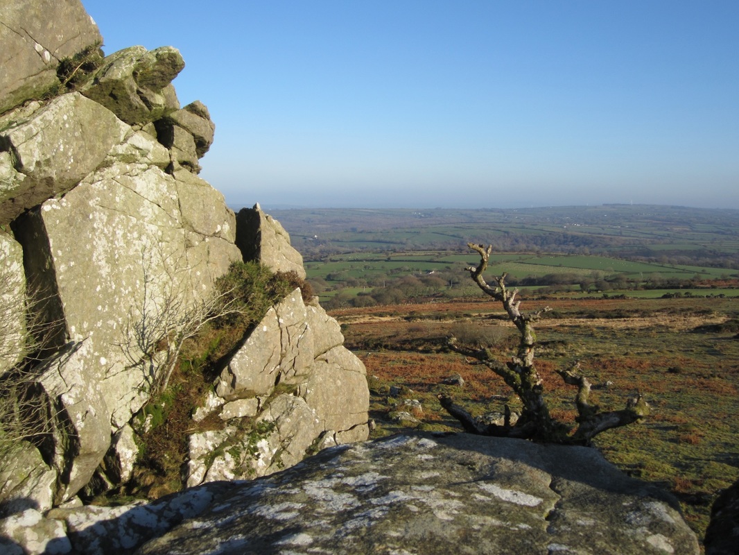
The summit of the mountain is protected in part by a fine defensive embankment, now somewhat ruinous but still obvious to all who climb up from the north or west. In its heyday it was probably 3m high, with a vertical outward face, and maybe even a timber palisade on top. When you climb up from the east the embankment is not so obvious; that is because the scree slopes on this side provided good natural defences against marauding warriors. So the embankment never did enclose the whole of the summit. There was a fortified village here, aligned more or less SW-NE, with four segments. The builders knew all about military architecture, and in some ways it was just as sophisticated as the stone castles of the Normans who followed maybe 2,000 years later.
In the south-west is a small outer enclosure and then a larger middle one, approached through a gateway passage with flanking walls from what is now the open common. Animals may have been brought into this flattish area at times of trouble. Then there is a “cross wall” with a gateway in it, which separates the middle enclosure from the “inner bailey”. This area encloses the three inhospitable craggy summits of the mountain; here there might have been some crude shelters against the rock faces, but the inhabitants would only have used it in times of great crisis. Then on the north-eastern side of the mountain (ie on the lee side) there are several natural platforms or steps on which we can still see hut circles and small enclosures. This was the main living area, and archaeologists think there may have been about 25 houses here, providing shelter for 150 people. These houses would not have looked like the round houses of Castell Henllys! Here it was far too exposed for such exotic structures to survive, and so we are talking about very crude shelters, partly excavated into the stony ground and roofed over with a low lattice of branches, thatch and animal skins. Possibly these “houses” were so low and primitive that it was not even possible to stand up inside them. This living area is enclosed by defensive walls on three sides. Altogether there are nine entrances through the main defensive embankment. On both the western and eastern sides of the mountain, outside the main defended area, there are scores of embankments, paddocks and the remains of other shelters which must have been used in the pastoral and farming economy, for keeping sheep, cattle and goats and for growing and storing human food supplies and fodder. These features are all prominent, except at the height of summer when the bracken is high. The most prominent features of all are two gigantic looped banks on the eastern side of the mountain at the foot of the scree slope. Who built the Carningli hillfort? In the nineteenth century most people simply assumed that “The Ancient Druids” built almost all of the old man-made features in the landscape, some time after Noah’s Flood had obliterated everything. Now we know that the Carningli village was occupied during the Iron Age -- but we still do not know for sure whether it was a permanent settlement, or one that was simply occupied during the summer season by people who spent their winters in the sheltered woodlands of the river valleys. The site has never been properly excavated, so there are very few clues to be interpreted. There are some old records which suggest the the mountain was occupied by vagrants and travellers well into the Middle Ages and maybe even later, and at the other end of the scale it is now suggested that the earliest occupants may well have been here during the Bronze Age around 3,000 years ago or possibly even in the Neolithic, more than 4,000 years ago. So some of the stone walls around the summit may be older than the pyramids of Egypt, and the site may have been occupied (intermittently) by many different groups of people over perhaps 5,000 years. Castell Henllys
This "Iron Age Village" site is intriguing, partly because archaeologists have been excavating here for over twenty years and partly because, under the ownership of the National Park, appropriate thatched buildings have been reconstructed on their original foundations. As a resource for understanding the Iron Age, Castell Henllys is second to none, providing a unique combination of Scheduled Ancient Monument, archaeological excavation and experimental archaeology.
Today, Castell Henllys (Welsh for "the castle of the old court") is set within thirty acres of beautiful woodland and river meadows. There is an excellent new visitor / education centre with an exhibition and gift shop and also a cafe. The Iron Age is explained by interesting interpretation panels, and visitors can stroll along leafy woodland and riverside paths, explore sculpture trails depicting myths and legends, pass by prehistoric breeds of livestock grazing in fields next to the path (don't miss the Iron Age pigs), before entering the hillfort itself. Four roundhouses and a granary have now been reconstructed here. The first to be built, the 'Old Roundhouse' was reconstructed more than twenty years ago and is the longest standing reconstructed Iron Age roundhouse in Britain. Carnffoi Hillfort
This is a much smaller and simpler hillfort than Carningli, located on a low rocky hillock near Ffordd Bedd Morris and just above the 200m contour. There is just a single enclosure, defined by a stone embankment (now much degraded) which links a series of rocky crags. There are signs of two entrances. There does not appear to have been a ditch outside the embankment. Possibly the fort was used by a small family group, and it may have been related to the much more sizeable “village community” which used Carningli during the summer months. There is a tradition that the fort was occupied by Irish marauding groups during the Age of the Saints.
The Green Ways
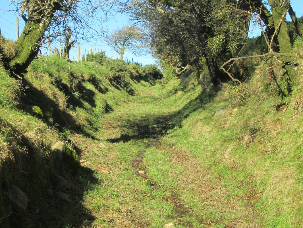
All round the flanks of the Carningli - Mynydd Dinas common there are wide “green ways” bounded by stone walls which connect the open moorland with the cultivated land at lower altitudes. They run between enclosed fields and paddocks, and some of them are very beautiful, with mature trees, grassy banks and patches of gorse and wold flowers. Most are public rights of way, but since they are between 10m and 15m wide in places they were clearly not intended solely for pedestrians or even people on horseback. In fact they were meant for the transfer of large numbers of animals between the holdings of the commoners and the open common, in such a way that the land owned by others would not be trespassed upon. So they are probably medieval for the most part, designated and brought into use by the Barony and then made, managed and maintained by landowners and tenants over 700 years or more.
The Newport Sea QuarriesOne of the most interesting traditions in Newport is the use of the sea cliff faces between Parrog and Aberrhigian for the quarrying of shale and slate. These materials were used occasionally for roofing purposes, but because they were softer and more friable than the best Preseli Hills slates they were not very durable or waterproof; and so they were most commonly used as slabs for building purposes.
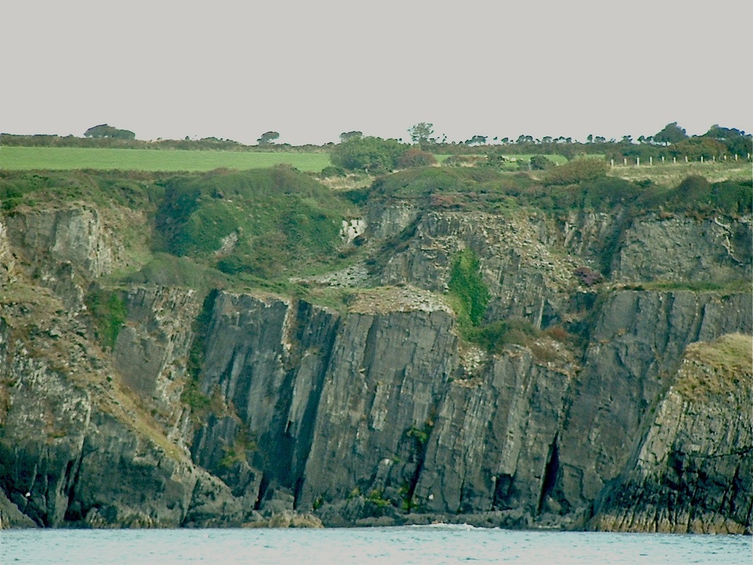
The sea quarries were operational over a period of at least 300 years, and in 1600 George Owen referred to the “black slate” as a major export item, sent by sailing ships to Haverfordwest, Tenby, Pembroke and ports in eastern Ireland. The main quarries were in Traeth Samuel, Chwarel Ffeiradon (Priest’s Quarry), Aber Step and Traeth Brodan. They were owned by the Llwyngwair Estate, although not much is known about the leasing and working methods used in the quarries. The most intensive working was in the bays closest to Newport, where thousands of tonnes of material have been removed from the rock faces. Near Cat Rock a whole peninsula has been cut through from one side to the other, drastically altering the configuration of the coastline. Walkers on the coast path can see many traces of the old quarrying activities, including small cuts and inclines high above the beaches (used for access, or to carry slate slabs up to the cliff tops), old working faces including occasional shelves and spoil heaps, and even small “docks” cut into the wave-cut platforms beneath the cliffs to facilitate access by barges and small sailing vessels. Most of the slate slabs were loaded directly into these vessels for transport either to Parrog or to Cwm-yr-Eglwys, where some cargoes would be trans-shipped into larger vessels for export. There was very little mechanisation in the sea quarries, but black powder was probably used as an explosive to break up the rock face, and wooden gantries with block-and-tackle arrangements would have been used for shifting the largest slabs of slate. There were two great advantages that these sea quarries had over those located inland: the capacity of the sea to remove the slate waste from beneath the cliff faces, and the “soft option” available to the quarrymen of loading their shale and slate slabs directly onto barges or ships without any need for railway lines, tracks or wheeled vehicles. Many of the slate slabs used for sills, lintels, doorsteps and scullery work surfaces in Newport and Parrog came from the sea quarries, as did many of the slabs used for building purposes. The sea walls, quays and slipways of the Parrog were built of slate and black shale from the quarries in the 1700’s and especially during the major building works around 1820. The quarries were still working in the mid-1800’s, but seem to have been abandoned well before 1900. Probably there were never more than 20 men working in the quarries at any one time. Foel Drygarn
About 4,000 years ago the “age of stone” gradually gave way to the “age of metal”. People became more sedentary; their communities grew larger: and they began to make quite sophisticated pottery. Weapons, tools and ormaments were made with copper and bronze, and trading activity (for example between South-East Ireland and Pembrokeshire) increased. The most interesting landscape features dating from the Bronze Age are perhaps the old circular enclosures, hut sites and field boundaries on Mynydd Carningli near Newport, but there are many other round barrows, embanked stone circles, and cist graves elsewhere in the county. By far the most spectacular Bronze Age features are the three massive drystone burial cairns on the summit of Foel Drygarn near Crymych. These mounds are contained within one of three defended enclosures thought to date from the Iron Age. The embankments are still well preserved, and this must at one time have been a busy place, for there are traces of no less than 220 hut sites here, many of which must have been used by resident families. Lime Kilns and Lime Burning
The tradition of burning lime in lime kilns goes back at least to Norman times, but the tradition of burning lime for the creation of an agricultural fertiliser in the Newport area probably began around 1500. George Owen, the eccentric local squire of Henllys, was a great advocate of lime burning, and he realized that lime could be used on the thin acid soils of the area to increase farm productivity.
As the Parrog developed as a port, small sailing ships called with greater and greater frequency, importing limestone fragments from the West Williamston quarries and culm from the collieries around Hook. These were the two essential ingredients for the lime burning operations, and rapidly became the most important of all the locally imported products. Before 1750 most of the lime kilns used in Pembrokeshire were crude temporary affairs, but with the mania for “agricultural reform” designs for solid permanent kilns were developed, and lime burning became an important local industry involving specialist lime burners and carters, and sailing ships devoted full-time to the limestone/culm trade. Lime kilns were filled with alternate layers of limestone fragments and anthracite fragments from a loading platform which could be reached via a sloping ramp. Horses and carts were generally used for transport. The fire was lit from below and then maintained for weeks or months on end; the burnt lime was raked out through the kiln “eye”, which also served to provide the draught needed for the combustion process. As the top surface in the kiln dropped it was replenished on a regular basis. The lime was taken away in a cart and was then left in the open until rain caused a chemical reaction, turning dangerous quick lime into the much safer hydrated or slaked lime which could be spread onto the fields or used in the making of whitewash and lime mortar. There were at least eight lime kilns in the Newport area, including four on the Parrog, one at Shiphill (Bryncyn), one at New Mill near Llwyngwair, and two on the shore of the estuary near The Marsh. There was another not far away at Aber Forest. Only three of the Newport kilns now remain, namely the impressive structure adjacent to the Pembrokeshire Coast Path at Bryncyn and the interesting “twin kilns” at the entrance to the Parrog car park. Next to these kilns is a little cottage which was built in 1788 (rather foolishly, on the downwind side) to house the lime-burner. It has recently been carefully renovated by the National Park Authority as part of the Parrog Enhancement Scheme. The Garn Wen Cemetery
The Garn Wen Neolithic cemetery, located north of Fishguard and the village of Goodwick, is quite a special place, because there are signs of several burial monuments clustered quite close together. The cemetery (on a patch of land which is somewhat overgrown) comprises three well-known monument in a north–south line. They are architecturally similar; each with a partially rock-cut chamber delineated by a series of short uprights supporting a large capstone. The best-preserved of the three is the southernmost monument, which is sometimes called Carreg Samson (not to be confused with the larger Carreg Samson near Abercastle), which has five uprights around a polygonal chamber supporting a large dislodged capstone. The builders of these tombs have simply used local slabs of rock that were lying around in the landscape. Recent clearing work suggests that there are at least two other similarly constructed monuments within this group, bringing the total to at least six.
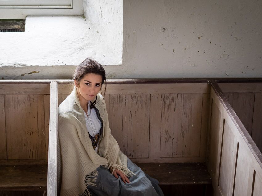
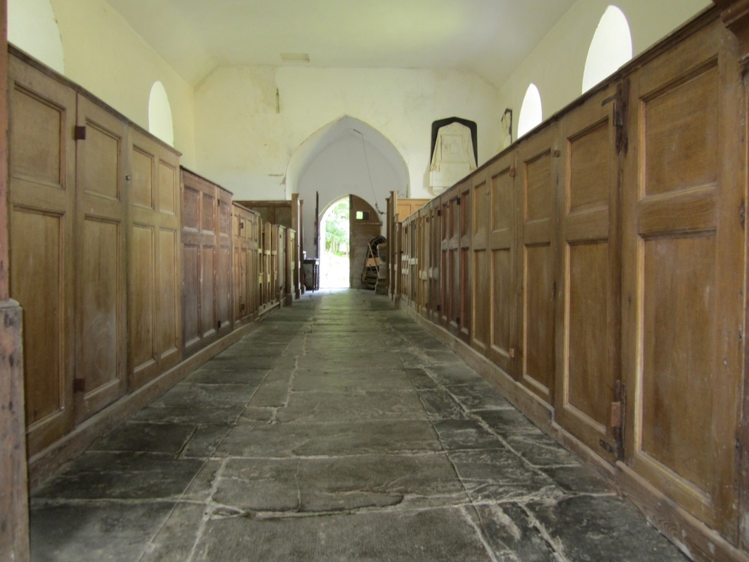
Bayvil ChurchSt Andrew's Church, tucked away along a lane near Bayvil Farm, is thought to be an early nineteenth century rebuilding of a medieval church although no perceptible early fabric remains. It is quite fascinating -- a modest but evocative late Georgian Anglican box with Gothick windows, and a completely intact, single chamber interior with plain whitewashed walls. The chief joy is the painted and panelled pulpit and reading desk, the former so tall it almost touches the ceiling with its sounding board. There remains a complete set of box pews (mostly for the commoners but with one for the local squire and his family) and an unusually elaborate memorial tablet against the east wall. This commemorates Morris Williams of Cwmgloyne, in the parish of Neverne, who died in 1840. In front of the pulpit there is a wooden bier used for carrying coffins in and out. The interior also houses a modest twelfth century square font. There is no interior lighting, but the church is still open to the public. It is no longer used for services, and is looked after by the Friends of Friendless Churches.
Hafod Tydfil
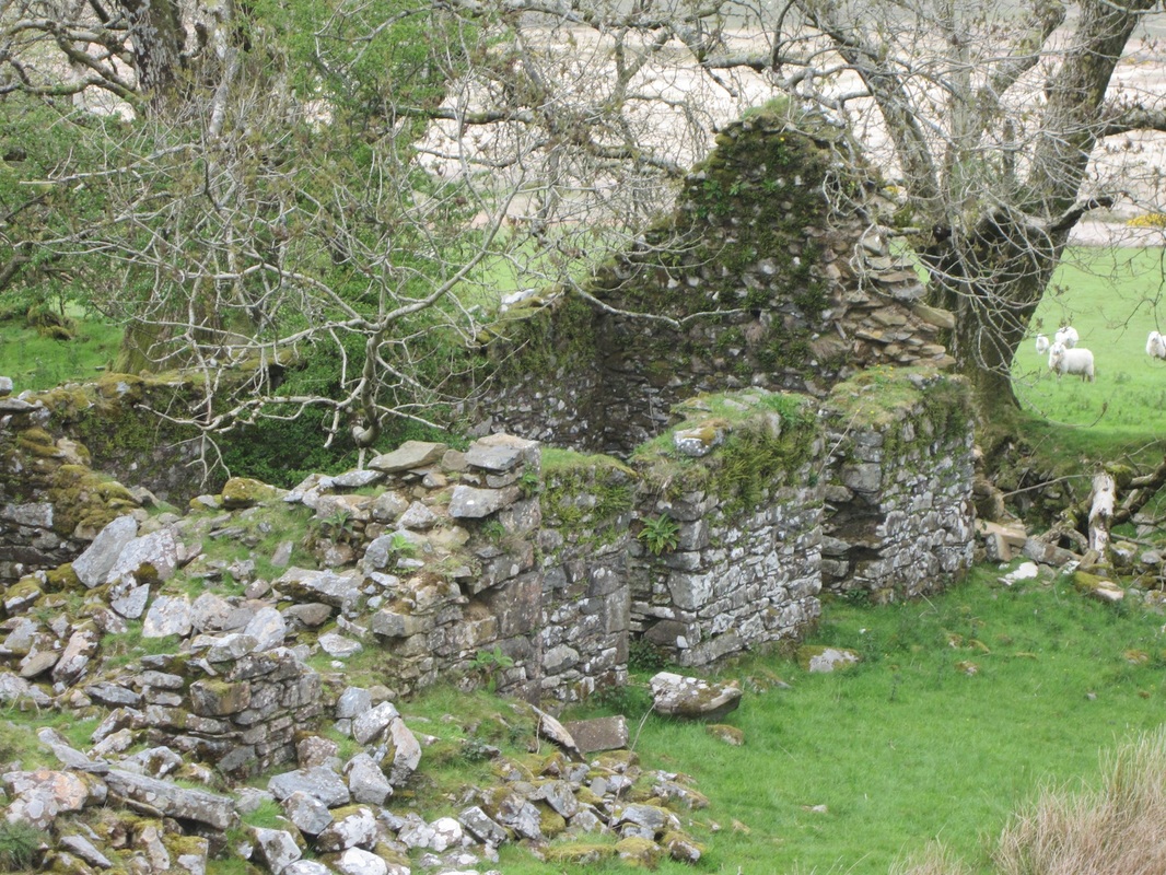
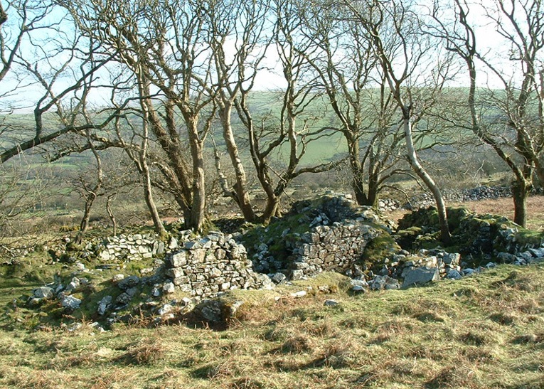
Hafod Tydfil is one of my favourite places. It's just a small pocket of enclosed land - 13 small fields - around a ruined farmstead, on the north-facing flank of Mynydd Preseli. It lies within the unenclosed land of the common on which the freeholders of Cemaes had been granted rights of pasture and turbary by a charter of Nicholas Fitzmartin in the late13th-century. In Elizabethan times it was a 'tenement of 8 acres', under the ownership of the Bowens of Pentre Ifan. It appears to have been one of several areas of former enclosure within the common, the evidence of which can be seen elsewhere as weathered bank systems, sometimes associated with deserted rural settlement sites on the moorland. It continued to be occupied until the 1950s, and for a short time the famous naturalist Ronald Lockley was a tenant here. In Welsh the "hafod" farms were originally the summer farms used for the grazing of animals in the summer months -- as distinct from the home farms in the lowlands which had the name "hendre" attached to them.
The Shell House, Cilwendeg
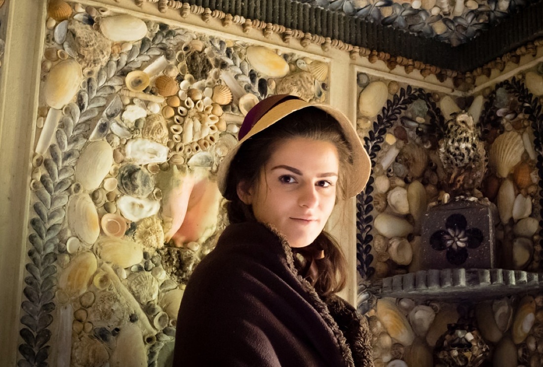
The Cilwendeg Shell House Hermitage is a very strange ornamental grotto, and a rare survival in West Wales, located in the woods close to Cilwendeg Mansion. It was built in the late 1820s for Morgan Jones (1787-1840), who inherited the Cilwendeg estate upon the death of his uncle -- along with the huge income produced by the privately owned Skerries Lighthouse. He created the Shell House in his uncle’s honour, and if we want to, we can call it an extraordinary and indeed bizarre folly. The decorative scheme of the interior walls consists of a profusion of native seashells, minerals and coloured glass fragments arranged in primitive patterns and impressed into lime mortar panels. The only exotics are the large Queen Conch shells that form a centre-piece in each wall panel -- a number of these had to be replaced during a major restoration in 2004 and were donated to the project by local residents (each conch arrived with its own highly interesting anecdote or family history). There is a cosy fireplace, and a series of grotesque "shell owls" perched on shelves. Both the ceiling and the external slate and timber verandah have been re-created based on archaeological findings. The preserved floor is laid out in a delicate design using the knucklebones of sheep and oxen – the useful by-product of a once thriving estate farm. It is believed the ladies of Cilwendeg Mansion devised the original patterns for the interior decoration. Conceived in the picturesque taste of the era, it was used as a cool woodland retreat in the summer months and a contemplative reading room in the depths of the winter.
Manordeifi ChurchThe chuch at Manordeifi is a beautiful bellcote church typical of the "Celtic" churches of North Pembrokeshire. It has a spartan interior with little interior decoration, and candle-lit box pews, four of them being larger for the use of the more prominent local families; the two easternmost of these are furnished with fireplaces. Elsewhere are open-back benches. The pulpit is plain and is partly built into one of the pews. The 13th century font is square on a circular shaft and a square base. The floor of the nave is paved with slates and there is a three-sided altar platform in the chancel. The bell, which was recently restored, dates from the late 15th century. Manordeifi also boasts several fine monuments - including one to Charles Colby who had the unfortunate distinction of having been killed by a tiger in India in 1852.
When in use the church would often be cut off by the overflowing Teifi river, and a coracle has traditionally been kept in the west porch to assist stranded worshippers. The Friends of Friendless Churches have recently completed a programme of repair to the fabric of the building, including the conservation of the rare surviving railings to monuments in the churchyard. Ffynone MansionThis is a fine mansion near Newchapel which was designed by the famous architect John Nash and built in the decade before 1800. It has many features of architectural interest, including an imposing facade. For a time it was owned by the family of Earl Lloyd George, and it is currently being modified for use as a hotel. There are many fascinating relics of Georgian and Victorian times round about the house itself, including a home farm, service block and stable courtyard, a waterfall and artificial lake, and walled gardens with a garden house and summer house. At one time there was a hydro-electric plant near the waterfall which provided electricity for the estate.
The Trecwn Tunnels
The most spectacular valley in Pembrokeshire is often thought to be Cwm Gwaun. But even more spectacular is the valley called Nanyt-y-Bugail, flanked by 400-foot cliffs and densely wooded valley sides. It is flat-floored, and runs in a sweep from Trecwn village towards Llanychaer. It's not very well known, because it is not accessible to the public.
In 1938 the valley was chosen as the site of a Royal Navy Armaments Depot, to store and supply naval mines and munitions ordance to the vessels of the fleet. The Germans knew roughly where it was, but they never found it, partly because there were false lights and decoys scattered about across the nearby countryside. The key to its success lay in the fact that munitions could be stored in 58 huge tunnels dug out of the steep valley sides, with each one served by a railway line. It continued to operate after the end of WW2. At its height during the cold war 400 permanent workers were deployed at the site, many of them living in an MoD housing estate in Trecwn. The site had an on-site, 2 ft 6 in (762 mm) narrow gauge railway, built using copper to reduce sparks. The weapons were both delivered to the site and then distributed using standard gauge rail to Fishguard, Neyland for Milford Haven, and latterly Pembroke Dock. RDAD Trecwn was decommissioned in 1992, but all 58 cavern storage bunkers and the extensive above ground network of storage sheds and other military buildings remain in place. Ownership of the site was transferred from the Ministry of Defence to Anglo-Irish consortium Omega Pacific in 1998, and then by court order to the Manhattan Loft Corporation in 2002. The site is being redeveloped as an industrial park. Cilgerran Castle
Cilgerran Castle is the most imposing castle in north-eastern Pembrokeshire. It stands on a precipitous, craggy promontory overlooking the river Teifi . The river here is just at its tidal limit, so the castle was able to control both a natural crossing point and the passage of seagoing ships. We cannot be sure when the site was first fortified, but the old records show that there was a Norman castle called 'Cenarth Bychan' from which Nest, the spirited and beautiful wife of the Norman lord, Gerald of Windsor, ran off with Owain, son of the prince of Powys during a Welsh attack in 1109. Cilgerran is first mentioned by name in 1164, when the Lord Rhys captured the castle here. It was retaken by the Earl of Pembroke, in 1204, only to be taken again by the Welsh during Llywelyn the Great's campaigns in 1215. However, eight years later, William's son, another William, regained control, and it was probably he who built the imposing masonry castle we see today.
Cilgerran's most striking surviving features are Marshall's powerful twin round towers and curtain wall, built to defend the castle's vulnerable or landward side (note how the towers' outward-facing walls are much thicker than those within). Nevern Castle
Nevern Castle is for the most part an earthwork with traces of masonry walls and deep rock cut ditches, sitting on a spur formed by the gorge of the Gamman stream on the north side of the Nyfer valley. It overlooks the church of Nevern and its associated churchyard containing early Christian crosses. It lies less than 2 miles west of the present day town of Newport, and it was once the centre of the cantref and Medieval lordship of Cemais. In the 12th century the Norman lord Robert FitzMartin and later his son William FitzMartin ruled the barony of Cemais from this castle. There was a bitter family struggle in the 1190’s between the Lord Rhys, William FitzMartin’s father in law, who had taken the castle from him when he went to fight in the crusade, and his sons. Initially this was an earth and timber castle around 1108-1110; but it was rebuilt in stone in the late 12th century. Lord Rhys was imprisoned in 1194 by his sons in this castle, probably in the base of one of the two towers whose remains have been uncovered by recent excavations. The castle was deliberately demolished by 1195 and the site was abandoned. The archaeological remains preserved on this site tell the story of the Norman and Welsh struggle for control of Pembrokeshire during the 12th century. There is open access, and the site is well worth a visit.
Llechryd Bridge
The River Teifi is crossed at Llechryd by a grade 2 listed bridge. It is by far the most attractive bridge in Pembrokeshire. It was built of local slate slabs in the 17th century with no less than eight arches and a low parapet, and with pointed buttresses to reduce the impact of water flow. It has been modified and strengthened since then, but it is something of a miracle that it has survived, and that it still appears solid, given that it is sometimes completely submerged beneath the swirling waters of the Teifi in flood. The bridge was part of an ancient drovers' road.
Glynymel MansionPlas Glynymel was built before 1800, in a charming location in the valley of Cwm Gwaun, close to the village called "Lower Town" or the Cwm, near Fishguard. It was well known in the Regency period because it was the home of the local historian and antiquarian Richard Fenton, who features strongly in the stories of Mistress Martha Morgan. The house is built on a platform quarried out of the valley side, and it might well have been designed by Fenton himself. At one time there were very elaborate gardens here, planted with exotic trees that survived remarkably well in this very sheltered location.
Carnedd Meibion Owen
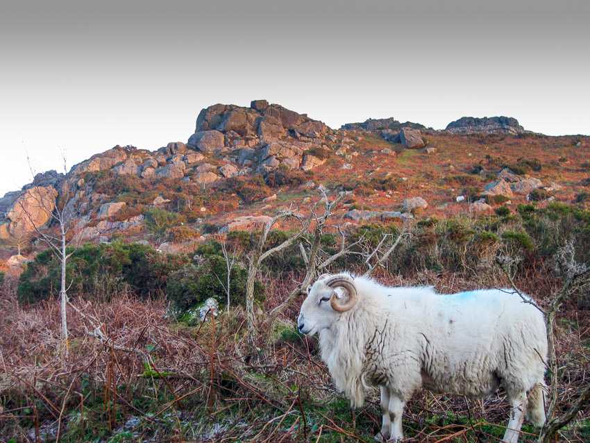
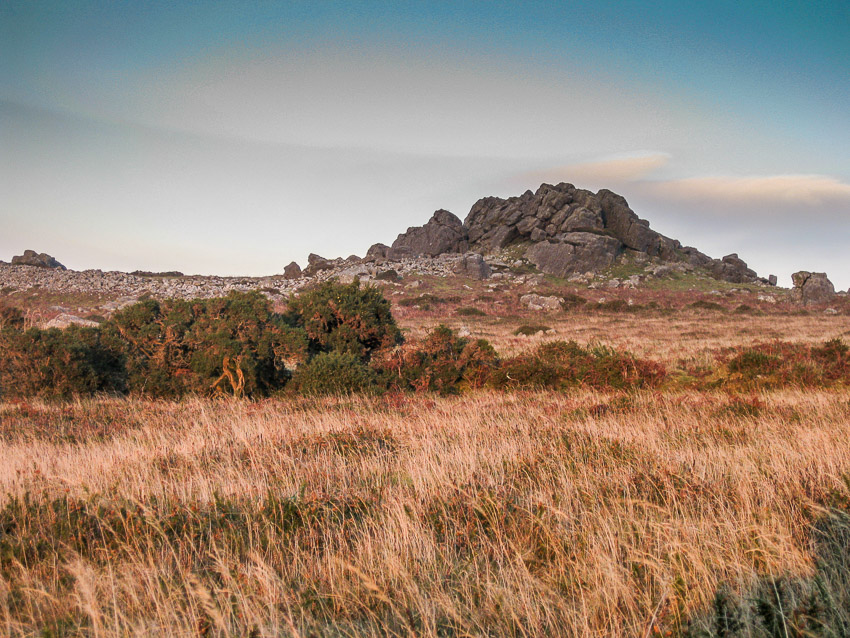
The four spectacular tors called Carnedd Meibion Owen stand high on a spur above the mysical woodland of Tycanol. They dominate the landscape. But why are they called "the rocks of the sons of Owen"?
Well, according to an old legend, this was the neighbourhood in which the last of the giants lived. The patriarch of the last family was called Owen. Like all giants, he was rather stupid, and he could not decide which of his three gigantic sons should inherit his kingdom. The three stupid youngsters started to argue about the inheritance, and the argument turned into a quarrel, and the quarrel turned into a pitched battle. The three fought each other on the hill summit by hurling rocks at each other, and all three of them were killed simultaneously by a rock thrown by one of the others. Then poor old Owen died of a broken heart. This legend is based to some degree upon historical fact, for the three sons of one Owen ap Robert of Coed Cilrhyd (near Pentre Ifan farm) are known to have fought one another with oak cudgels up among the rocks, in order to resolve the family inheritance.
|
