Favourite Places
(not in alphabetical order)
HERE WE PROVIDE INFORMATION ABOUT SOME OF THE MOST POPULAR AND INTERESTING LOCATIONS IN MARTHA MORGAN COUNTRY, FROM MATHRY IN THE WEST TO CARDIGAN IN THE EAST.
Bedd Arthur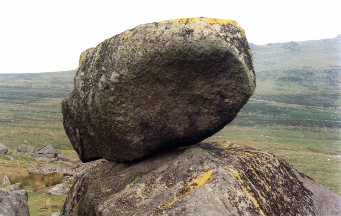
Mynydd Preseli has strong associations with the mysterious King Arthur. For example, in the story of Culhwch and Olwen related in “The Mabinogion” King Arthur and his knights fought a pitched battle with the monstrous boar Twrch Trwyth and his cohorts in the depression of Cwm Cerwyn. According to tradition the corpses of those who were slain were petrified in the rocks of Cerrig Marchogion. In English this means “the rocks of the knights”, and when low cloud is swirling around them it is easy to imagine them as the phantoms of the fallen. A tor called Carn Arthur has a gigantic boulder perched on top of it, and not far away is the oval stone setting called Bedd Arthur, or “the grave of King Arthur”. King Arthur was a very kind fellow, since he allowed himself to be buried at many different places within the UK. Very little is known about the stone setting, and it has not been excavated. Finally, two standing stones in Cwm Cerwyn are named Cerrig Meibion Arthur, or “the stones of the sons of Arthur.” There has been much speculation as to why these Arthurian names exist in this area. Were they given to features because of the area’s mysterious and magical atmosphere? Or alternatively, could it be that we see Mynydd Preseli today as magical and mysterious largely because a magical and mysterious king is supposed to have been here on at least one heroic quest?
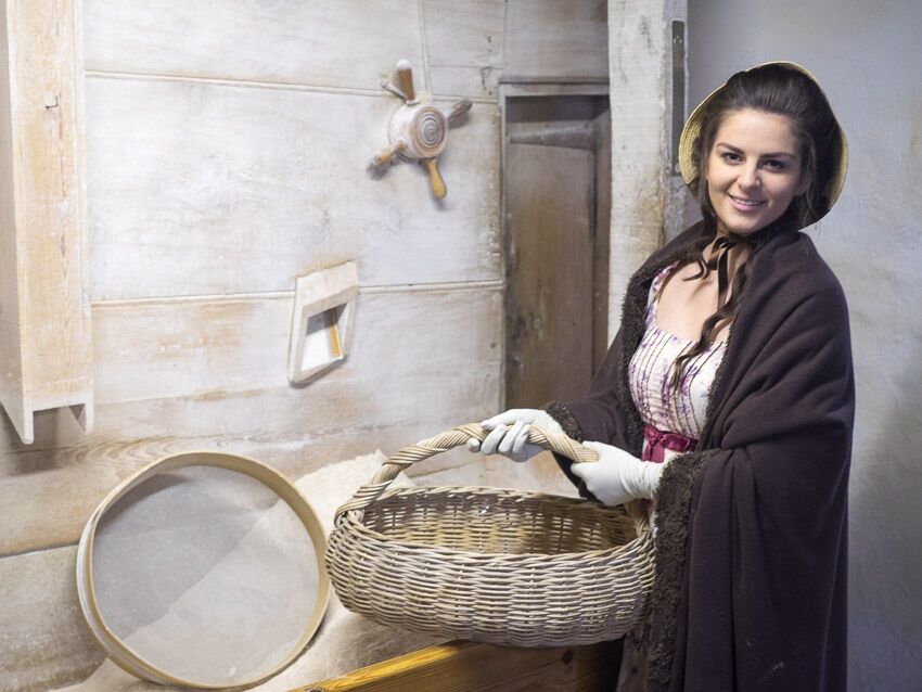
Tregwynt Woollen Mill
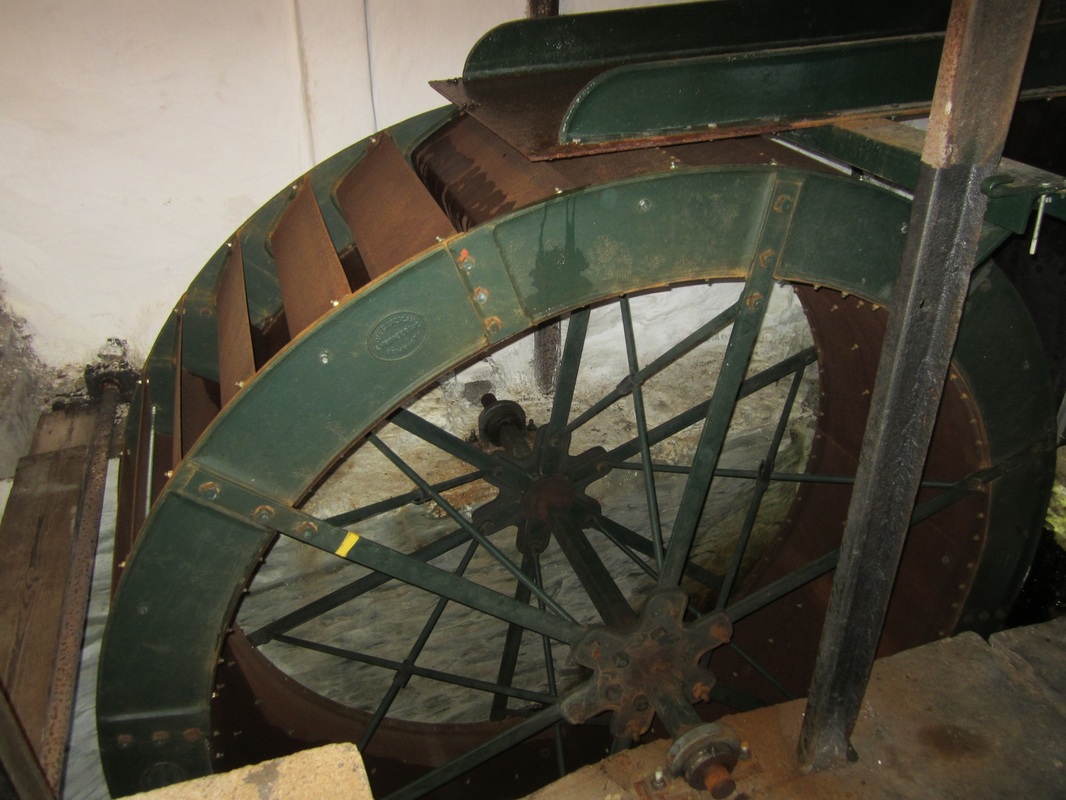
Melin Tregwynt dates from the 18th century. It was originally part of the nearby Tregwynt estate, and it was originally a corn mill. Then it became a fulling mill (also known as a pandy mill). Water from the local stream was used to drive hammers and beat the woollen cloth to clean and soften the fabric. In those days it was known as Dyffryn (Valley) Mill. Later the production of flannel and felt gave way to the weaving of woollen cloth. The water wheel was used to drive leather belts off which the carding engines and early power looms would run. You can still see these in the old part of the mill. The stream used to power 4 mills in this valley. Only Tregwynt Mill is now still working and you can see the old mill wheel inside the original building.
In 1912 Henry Griffiths bought the mill for £760 and moved from Efailwen with his new wife Esther. Henry’s family originally ran a pub at Glandy Cross, but both his parents died young, so he went to live with his cousin Stephen who was a weaver and taught Henry how to weave. The young couple renamed it Tregwynt Mill after the original estate. Their son Benjamin was born in 1914 and his younger brother Howard in 1916. Sadly Esther died young and at the age of 14 Howard left school to work with his father in the mill. After shearing their sheep the local farmers would sell their fleece to the mill. Henry and Howard would wash the fleece, card and comb the wool and spin it into yarn. Most of this yarn was sold back to the local farmers for knitting and weaving. Any surplus was taken by pony and trap to sell in the local markets. The mill prospered. During the 1939-45 war, wool for knitting was not rationed, and so much of the mill’'s production was given over to making knitting wool for local ladies to knit. After the war weaving of tweed cloth and traditional blankets and bedspreads began again, but now yarn could be bought from the wool marketing board rather than the local farms; and it became possible to buy a wider variety of different qualities of wool for weaving. Today the heavier Welsh wool is more commonly used for carpets. The 60s and 70s were busy times for the Welsh Mills. Welsh Tapestry fabrics and clothing with their bright colours and strong designs were very popular and appealed to tourists and locals alike. But the 1980s recession saw many of the Welsh Mills close. Melin Tregwynt was lucky. Howard’s son Eifion had come home to join the family business and began to develop markets further afield. New yarns and new designs kept the mill and its staff busy supplying customers all over the world. Fast rapier looms replaced the older flying shuttle looms and the mill developed a reputation for supplying high quality, beautiful designs in wool and lambswool, initially for the interiors market, but now also for fashion. Over 20 local people work at the mill today, and their products can be found in design-led shops and hotels all over the world. Strumble Head
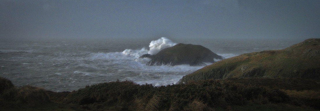
This is a glorious wild stretch of coast, savagely impressive when there is a storm blowing and driving the rollers in over the craggy rocks. The Strumble Head lighthouse is located on the island of Ynys Meicel, accessible across a bridge from the mainland. The station was built in 1908 by Trinity House for the greater safety of sea traffic between Ireland and the new Fishguard Harbour which is located behind cliffs and a breakwater three miles to the east. The new light also formed a link with the existing South Bishop light, 18 miles to the south-west. This stretch of coast is very dangerous, and some 60 vessels are known to have been lost along it in the 19th Century alone.
Because this site is easily accessible by road it is very popular with bird watchers and seal and porpoise watchers, and an old MOD building has been preserved here to provide shelter for people and their binoculars. Just along the cliffs from the MOD shelter there is a famous exposure of pillow lavas, formed 450 million years ago during submarine volcanic eruptions. Carn Alw
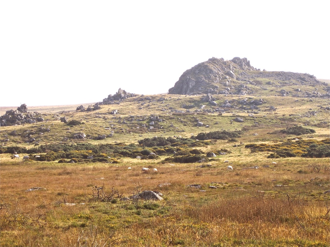
Carn Alw is a prominent rocky crag or tor on the northern flank of Mynydd Preseli. It is made of rhyolite, a hard and flinty volcanic rock which outcrops also in a number of steps or ledges on the downslope side of the main crag. There is a very long history of settlement here, and there are traces of Bronze Age walls, enclosures, hut sircles and standing stones scattered all over the grassy dry heathland.
Because the main crag offered fine defensive possibilities, it was used by an Iron Age tribal group for a fortified or defended settlement on a similar scale to that of Carnffoi near Newport. The defensive embankments and settlement platform are easily discerned. One of the most interesting features of the fort is a "chevaux de frise" or barrier of pointed stones set in the ground in order to deter enemies who might have considered a cavalry charge......... This is a perfect place for a picnic on a fine summers day -- but bear in mind that there is an ancient tale of a local man who went off to investigate some ethereal music somewhere near the cliffs, only to be taken away by the fairies. Abermawr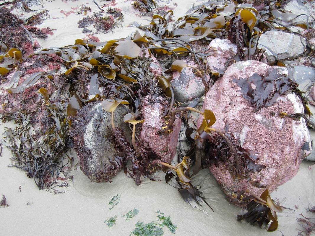
Abermawr is one of the loneliest and loveliest bays on the Pembrokeshire coast, even though it is easily accessible by road. There are no buildings on or near the beach. It might all have been so different, since the famous engineer Isambard Kingdom Brunel intended, in the 1850's, that his South Wales Railway should have its terminus here, with quays, hotels, warehouses and breakwaters and all the other things associated with the coming and going of transatlantic liners. But then the plans were changed because of physical difficulties on the route, and the railway was never built. The terminus was built in Neyand instead, and later on another line terminated in Goodwick.
But Abermawr did eventually play its part in the development of international communications. In 1862 Abermawr was chosen as the point at which the first telegraph cable across St George's Channel entered the sea. Two cables were laid on the sea floor, one to Wexford and another to Blackwater. In Ireland, the cable was connected with the transatlantic cable that ran from Valentia Island to Newfoundland. The little hut used by the telegraph operators can still be seen, close to the car parking area. Nowadays Abermawr is specially valued by earth scientists because the deposits exposed in the cliffs tell a long and complex story of environmental change during and after the last glacial episode. Sometimes, following winter storms, the submerged forest can be seen at low tide. |
Pwllderi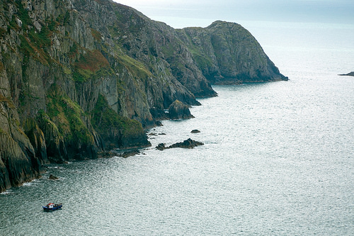
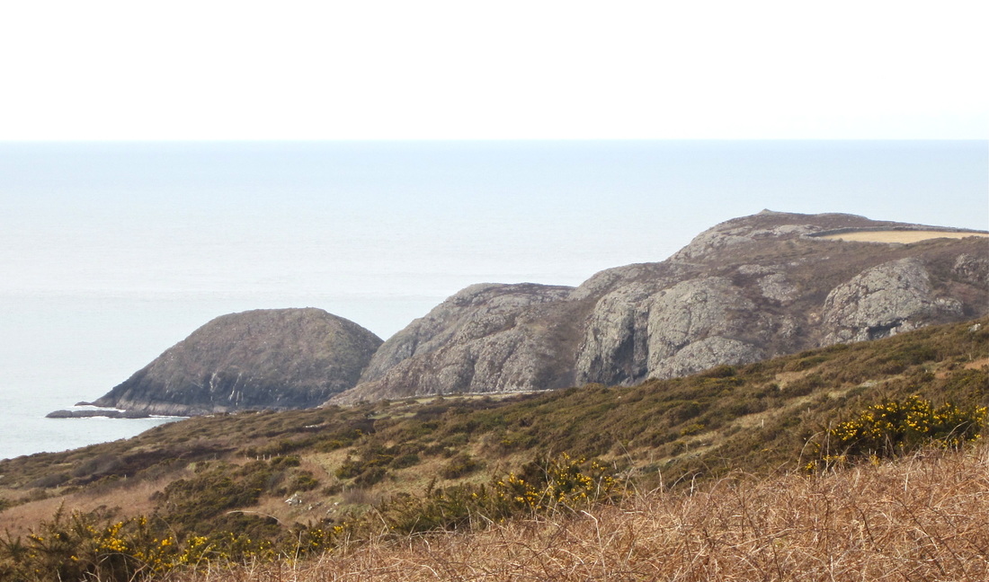
Pwll Deri boasts the most magnificent cliff scenery in Pembrokeshire, with cliffs 400 feet high and a Youth Hostel with a view to die for. The whitewashed building is perched in an idyllic cliff-top setting with spectacular views and glorious sunsets. This is also a great spot for bird and seal watching and the Youth Hostel is a fine base for those who want to walk the Pencaer section of the Coast Path. The tip of the peninsula at the SW end of the rampart of cliffs is called Penbwchdy -- the point of the black billy-goat. Very strange.......
If you climb the hill behind the youth hostel and nearby cottages, you reach the impressive Garn Fawr hillfort, located on the highest point of the Pen Caer/ Strumble Head peninsula. A short distance from the youth hostel, near the road, there is a memorial stone for Dewi Emrys (1879-1952), whose poem "Pwll Deri" celebrates the area and its characters. Dewi won the Chair at the National Eisteddfod and infamously pawned his 1926 Eisteddfod crown in Swansea. There is a nearby stopping point for the shuttle bus which runs from Fishguard to St David's, 7 days a week during the summer. Carregwastad Point
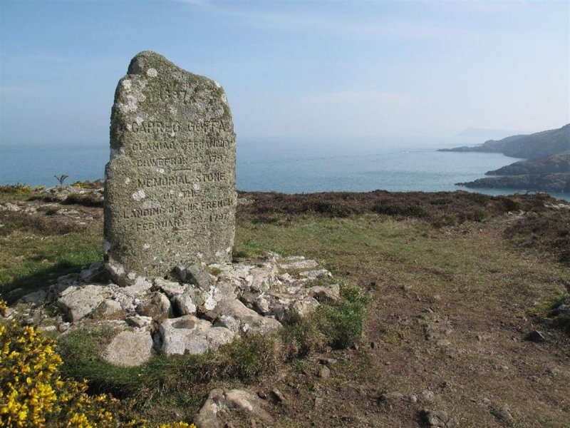
Carregwastad Point is a rocky peninsula on the northern coast of Pencaer which happens to have very convenient gentle slopes dropping down to the waterline instead of vertical cliffs. That is because this part of the coast is well sheltered from the prevailing south-westerlies -- so wave attack and coastal erosion rates are much reduced. When the French Invasion force approached this coast in 1797, one of the men on board the leading vessel was a disenchanted local Welshman who knew the coast well, and probably he advised General Tate and the ships' commanding officers where they could put men and supplies ashore. A short distance inland there is a memorial to the short-lived and rather farcical invasion -- the last time that foreign troops set foot on British soil with aggressive intent.
In the story recounted in "On Angel Mountain" David and his servant Billy are involved in a skirmish with a troop of French soldiers, and play a key role in the defeat of the invaders....... Y Felin, St Dogmaels
Y Felin is one of a handful of working water-powered corn mills left in Wales. It was in operation in the 1640s, and has operated more or less continuously since then. it may originally have been connected to the Abbey next door. The mill was worked by several generations of Gwynnes until 1926. After that, it fell into disrepair. The mill is today owned by Mike and Jane Hall, who purchased it in 1977 from the estate of the late Mrs. Phoebe Mary James, the last descendant of the Gwynnes to live at the mill. Since the beginning of 1980, the Halls have been restoring the mill to its former state. The millpond was reflooded for the first time in nearly thirty years on Easter Saturday, April 18th, 1981. Now it produces a range of stoneground flours, and the mill is a popular tourist attraction. Just across the road from the millpond is the Coach House Visitor Centre, run by Hanes Llandoch.
Martha does not visit this mill in the Saga, but another small corm mill which must have been very similar does figure in "On Angel Mountain" when Martha saves the inhabitants from a catastrophic flood. Cwm yr Eglwys
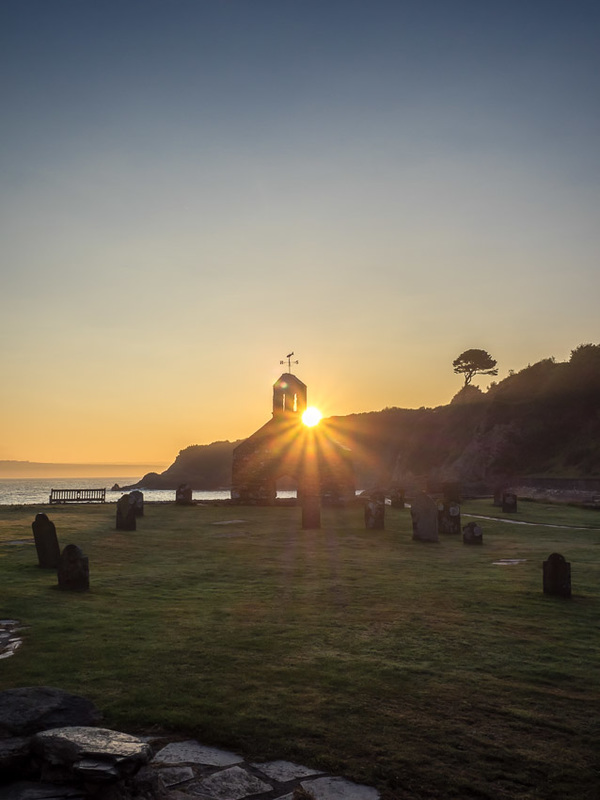
This is a popular holiday spot with a cluster of cottages, a caravan park and a sheltered sandy beach perfect for families. It's a popular place with sailors and walkers too. Before the substantial sea wall was built the medieval church of St Brynach, surrounded by its graveyard, was on a slope leading down to the beach. But it was vulnerable to coastal erosion when the wind was in the east, and gradually the graveyard was nibbled away and the fabric of the old church itself came under threat. It was being seriously damaged by storms by about 1850, and then in the great storm of 1859 almost everything was destroyed. One gable end with a bellcote was left standing, and it still stands there in stark beauty, surrounded by a few gravestones, some of which are in their original positions. The new church was built up at the top of the hill on the edge of the village of Dinas in 1860.
In the story "Dark Angel" Owain goes out from a fishing trip from Cwm yr Eglwys and disappears without trace. Bit by bit, from forensic examinations on the slipway, the wizard and sleuth Joseph Harries pieces together what happened....... Llysyfran Reservoir
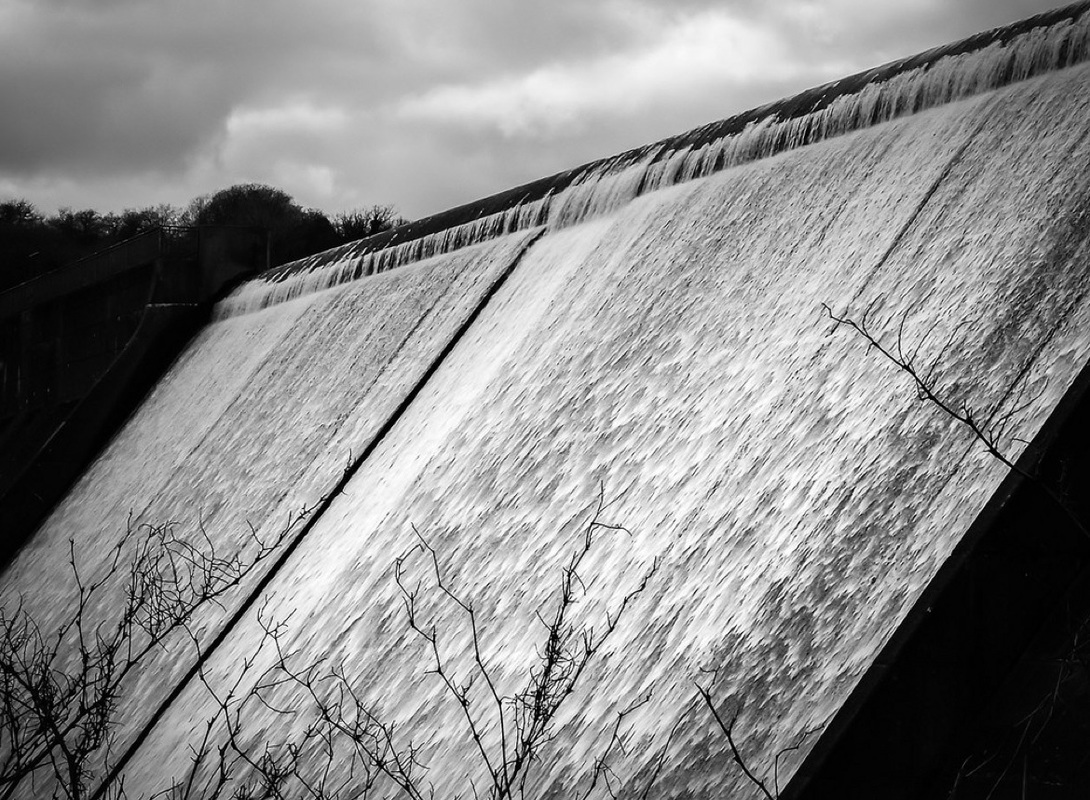
Llysyfran means "the court of the crows". The creation of the vast body of water at Llysyfran was a consequence of the industrialisation of Milford Haven. With oil refineries and Pembroke Power Station to be fed with fresh water for cooling and other purposes, it was apparent from an early stage that neither the Rosebush reservoir nor river extraction could guarantee the millions of gallons of water per day that might be required. So the Llysyfran dam, over 30m high and 300m long, was built in 1968-71 across the valley of the Afon Syfynwy, impounding a lake about 2.5 km long and containing 2,000 million gallons of water. The lake is used to regulate the supply of water into the Eastern Cleddau river system, and it is managed in conjunction with the extraction plant and holding reservoir at Canaston Bridge some 15 km downstream. Because the reservoir is not used for the supply of drinking water directly into the local “piped water grid” limited recreational use is permitted, and sailing, fishing and rowing on the lake are now very popular activities alongside walking, cycling and birdwatching on the shores. The Country Park at Llysyfran, with its attractive Visitor Centre (opened in 1990) as the focal point, is now one of Pembrokeshire’s prime inland visitor attractions.
|
